

Files
Download Full Text (163.9 MB)
Description
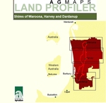
This CD-ROM contains land resource maps and land management information for the shires of Waroona, Harvey and Dardanup. It was produced by the Department of Agriculture Western Australia. Also included on the CD is technical information which may now be out of date.
Publication Date
2001
Keywords
soils, horticulture, land capability
Disciplines
Agriculture | Natural Resources Management and Policy | Soil Science
Recommended Citation
van Gool, D,
Tille, P J,
Kininmonth, I,
Goulding, P M,
and
Louise, M.
(2001), Agmaps land profiler CD-ROM. Shires of Waroona, Harvey and Dardanup. Department of Primary Industries and Regional Development, Western Australia, Perth. Book.
https://library.dpird.wa.gov.au/agmaps/8
This file is 163.9 MB. Files over 3MB may be slow to open. For best results, right-click and select "save as..."
Included in
Agriculture Commons, Natural Resources Management and Policy Commons, Soil Science Commons
Comments
This is a published archival CD (put in a large zip folder) that uses html to navigate maps and reports. When downloaded and placed on a hard drive in one location it works by clicking on start.htm. In 2015 it was briefly tested and still works on windows 7 using Internet explorer 9 and Google chrome Version 46.0.2490.86 m.